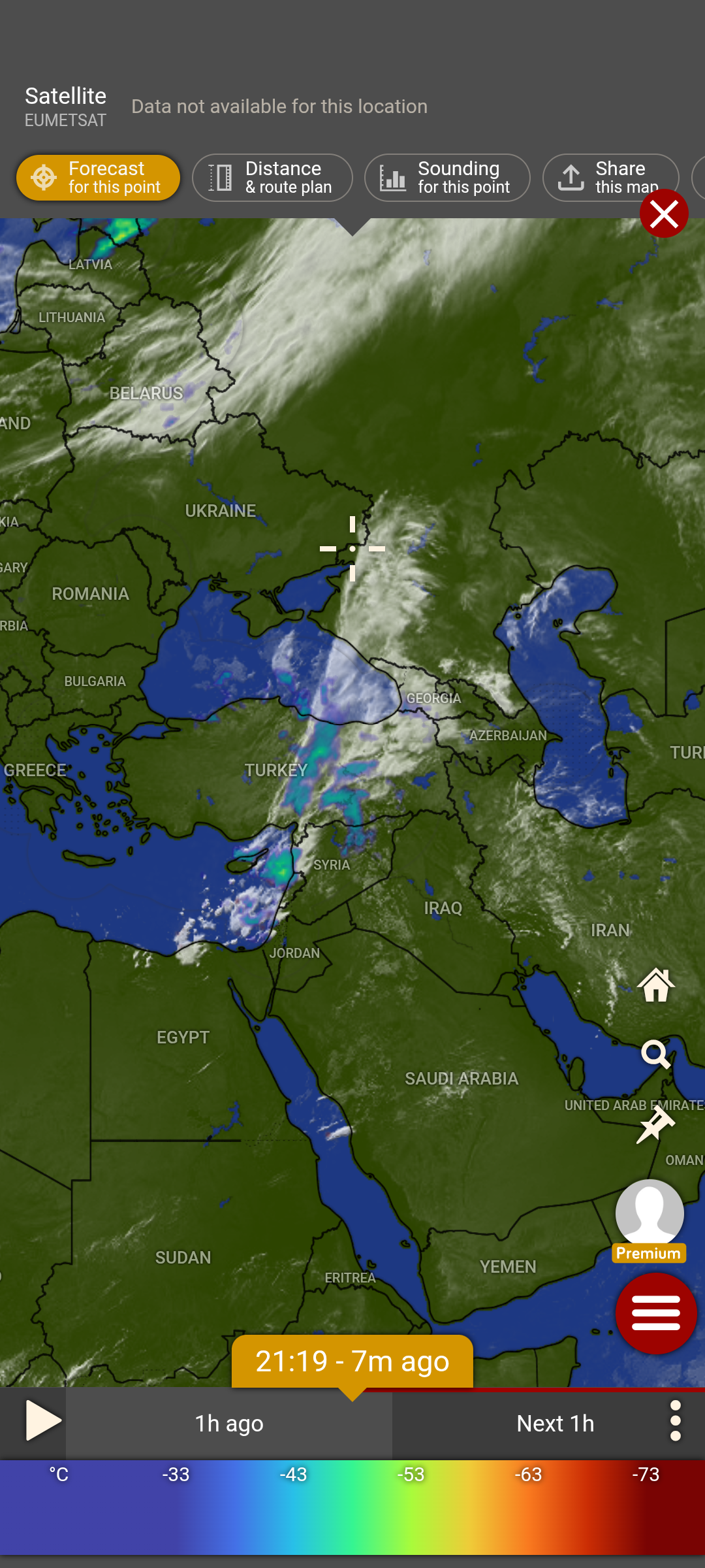
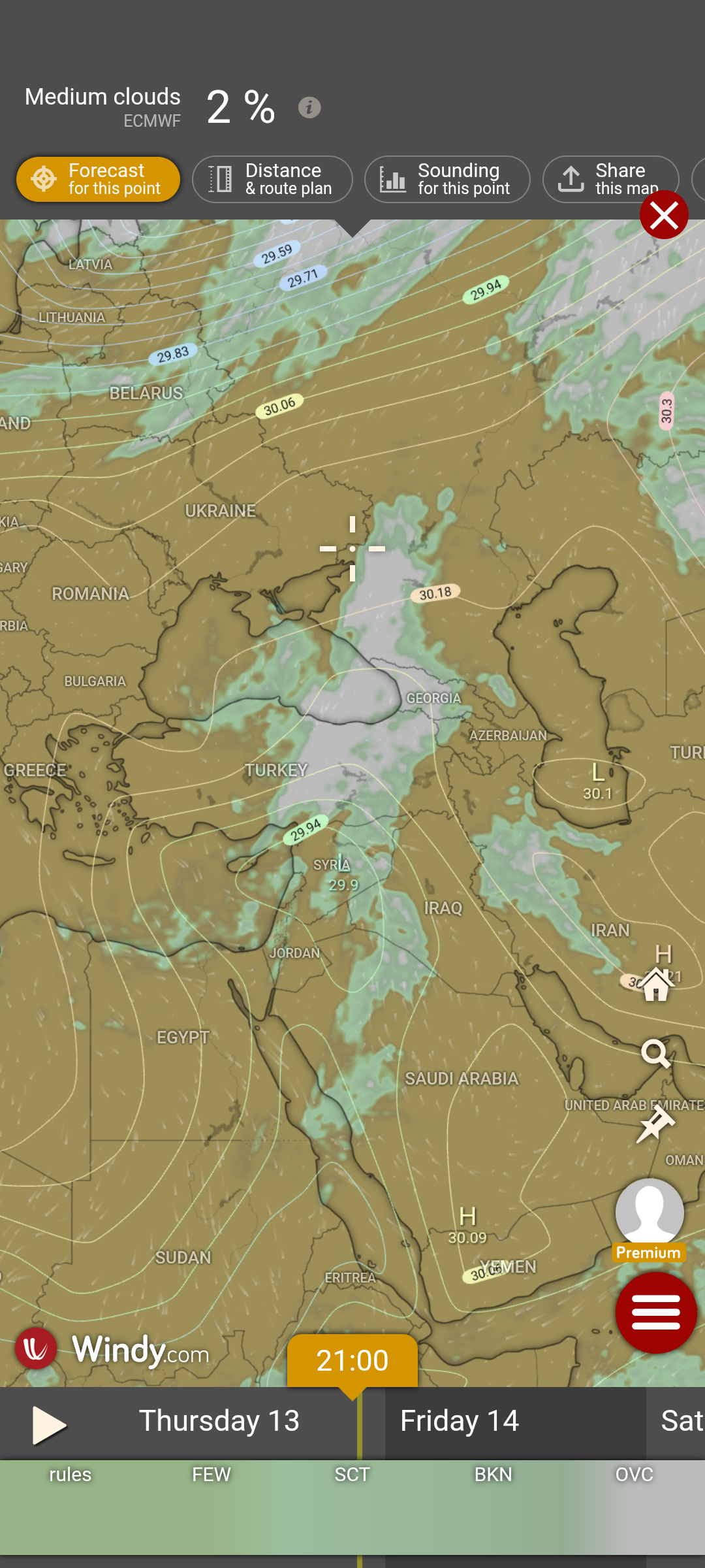
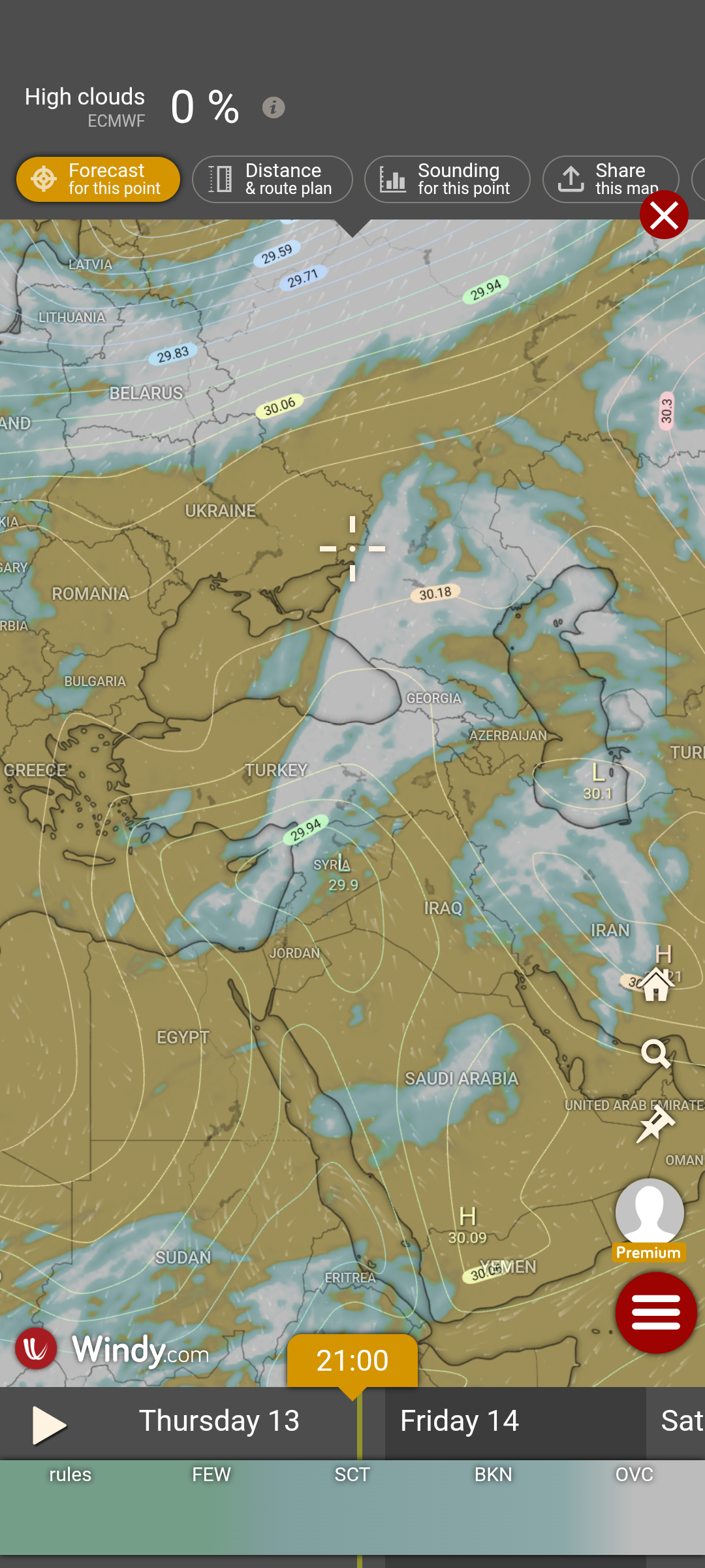
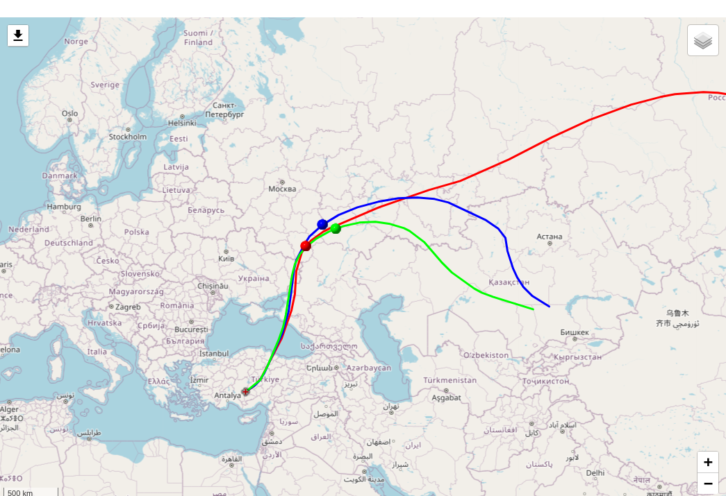
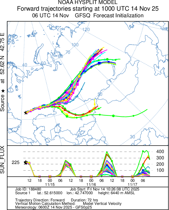
Track predictions
Forward predictions for 2025-11-14
There are no spots today, but yesterdays prediction had the ballloon too far north for the sun to activate it.
Doing a new prediction using these starting lat/long points 1025, 40.5880, 50.9080, 254. 2025, 42.7470, 52.6150, 227. 3025, 44.4120, 52.2830, 240.
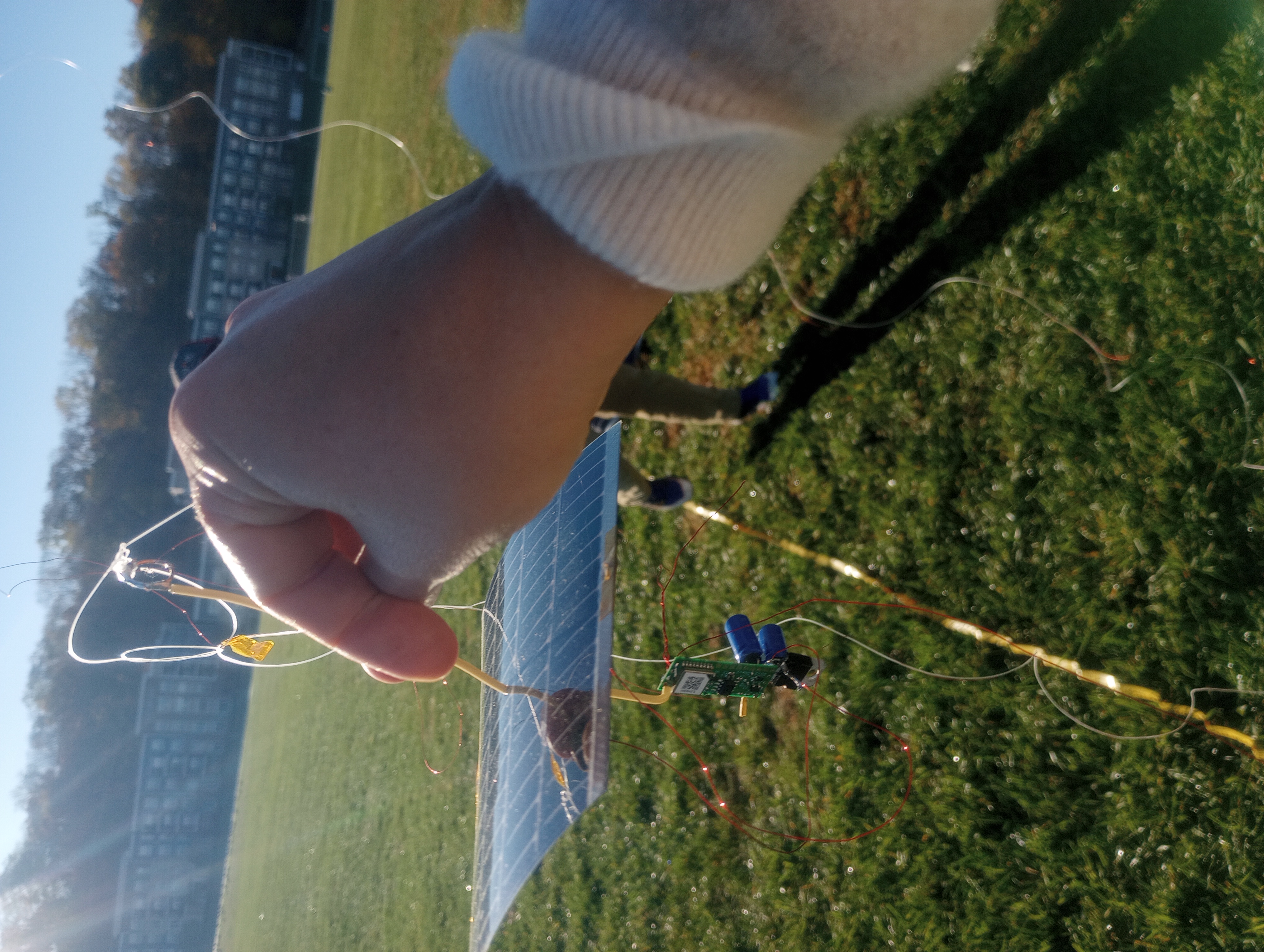
Payload weight
- USB connector removed from U4B.
- With antenna winders: 31.7 gram.
- Antenna winder 1: 7.6 gram
- Antenna winder 2: 7.4 gram
- Total antenna winder: 15 gram
- Payload weight: 16.7 gram
Launch 2025-11-06
Tracking link: https://wsprtv.com/?cs=kf8eez&ch=109&band=20m&start_date=2025-11-06&sun_el=25
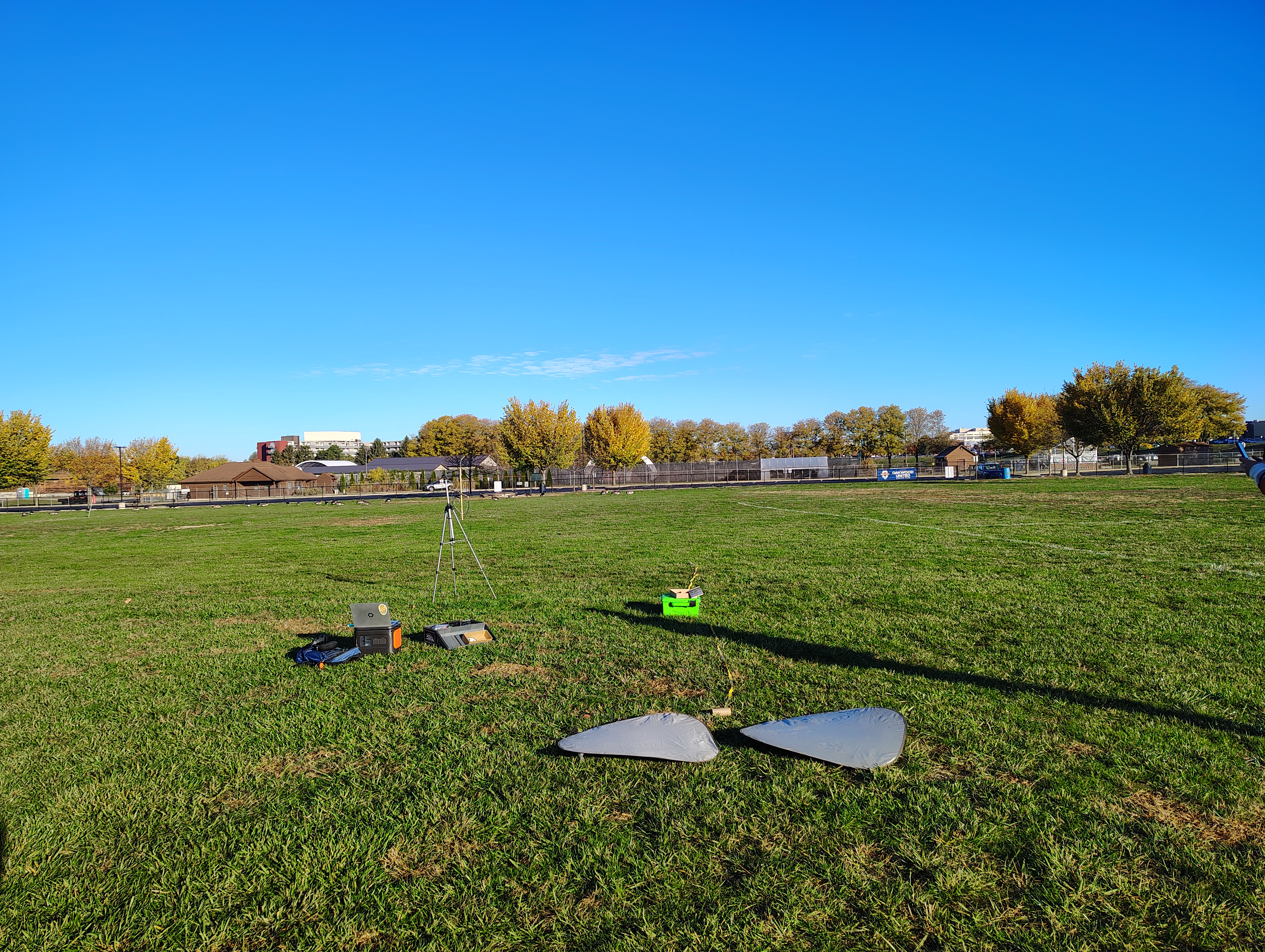
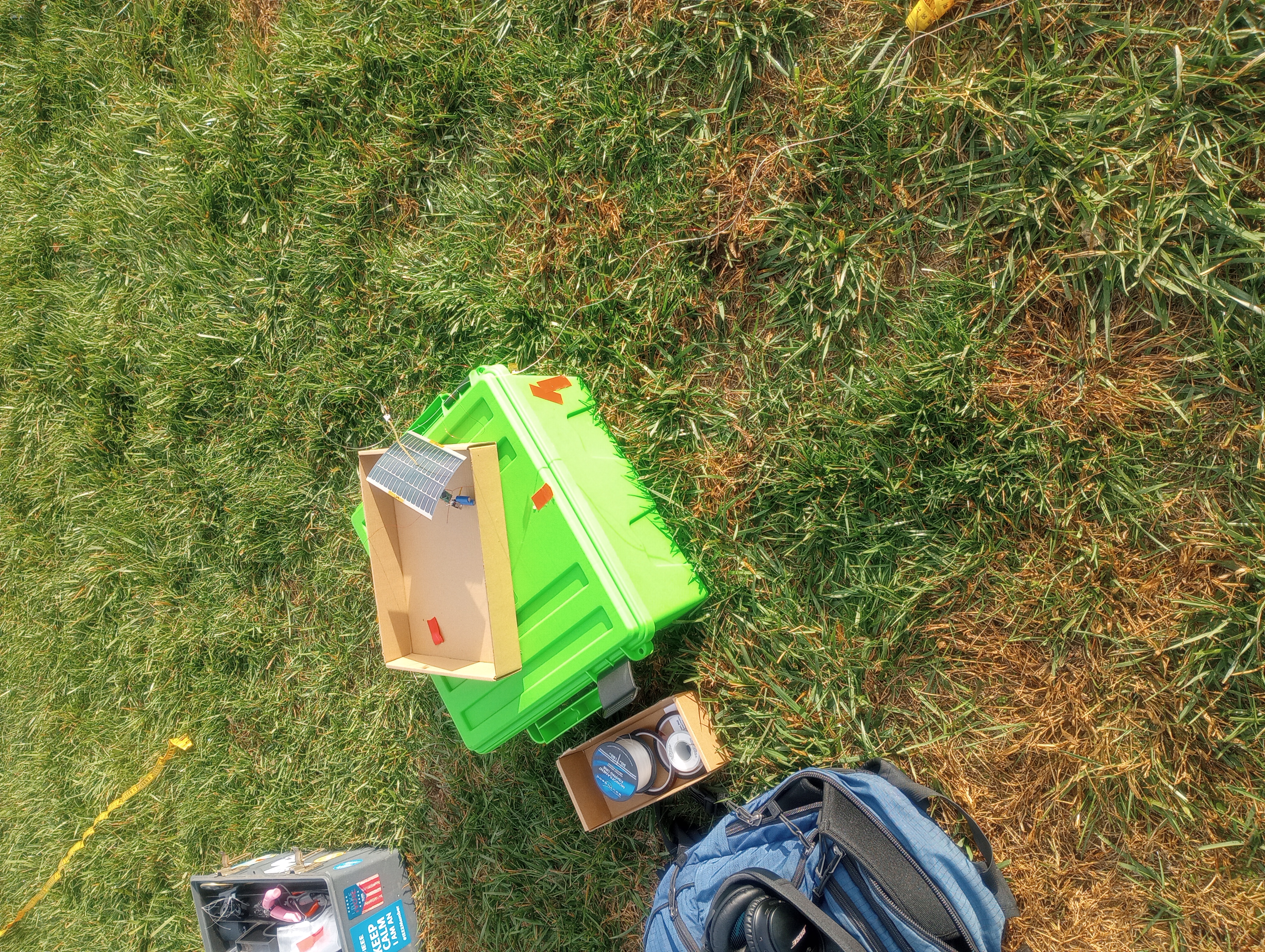
Field before launch
Clear, no wind, but geese. The geese were not a problem and just got out of the way.
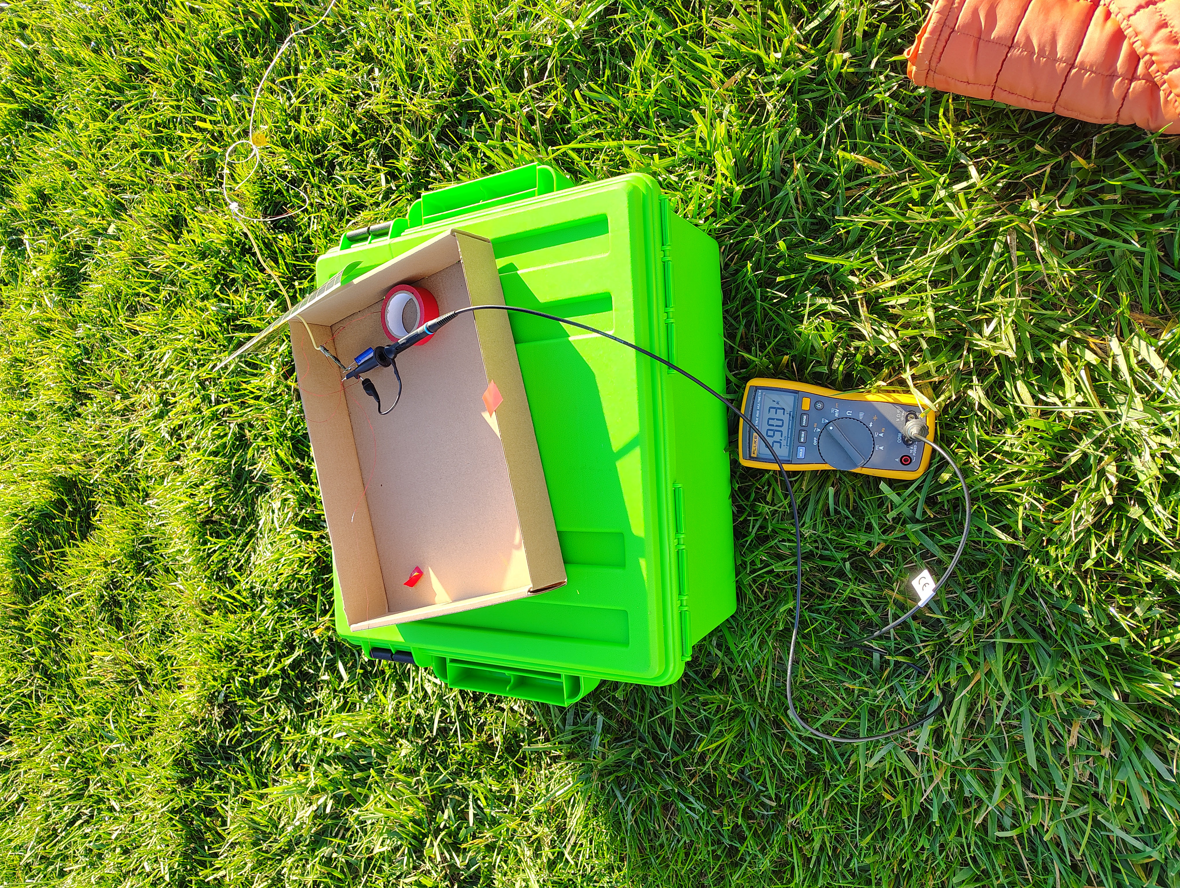
Measuring solar panel voltage
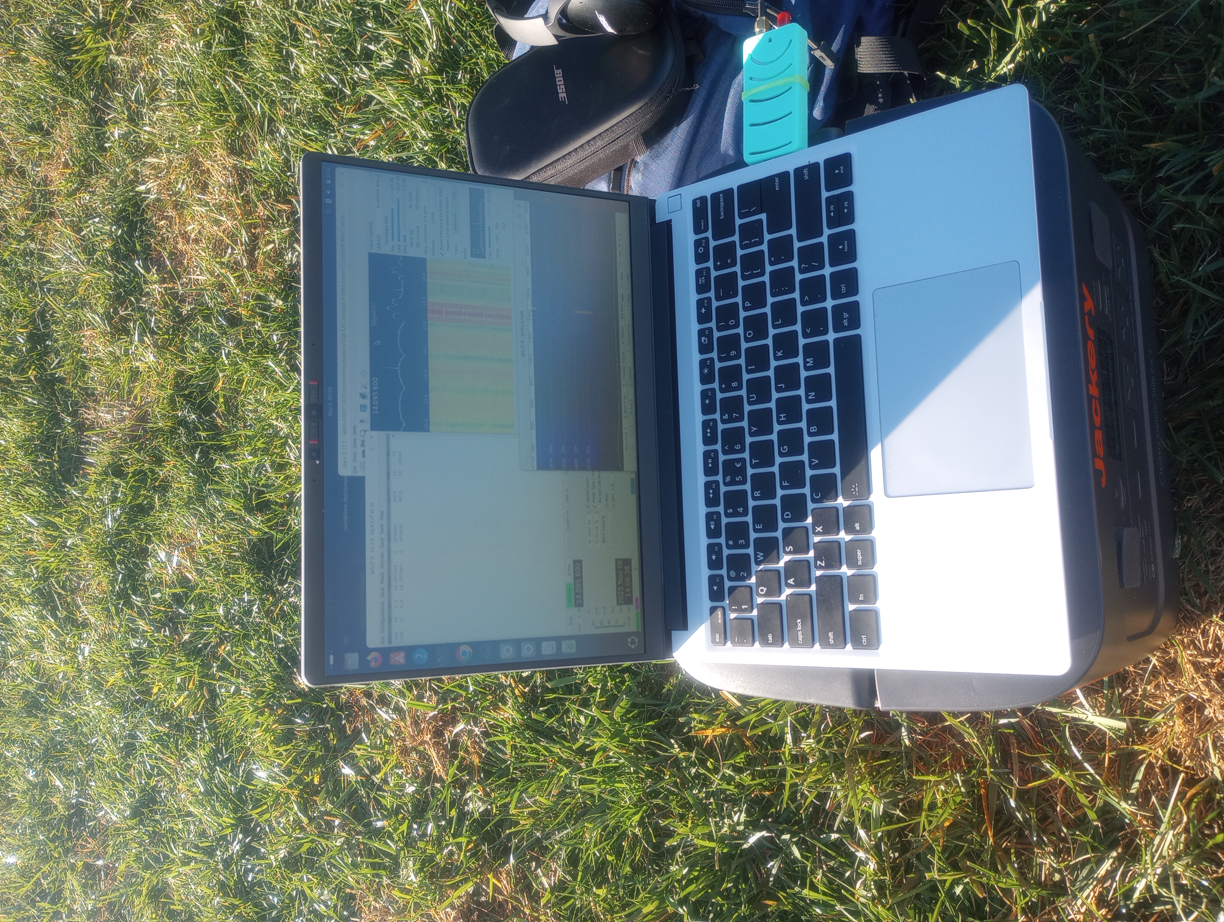
Ground WSPR monitor
I’m using a LimeSDR and homebrew mag antenna to monitor for transmissions at the launch site.
Attempts
Attempted Launch 2025-10-04
Attempted a launch but failed for two primary reasons:
- payload failed to power up and transmit at launch site
- one balloon lost about 75% of it’s gas can could not provide lift
Subsequent testing of the payload shows that it’s working fine, and transmitting OK. Currently hung up on test system in yard. See WSPRtv
The weather high clouds and the attempted launch was early. I suspect that the solar intensity was too low to power the transmitter.
Also learned of a new risk: Canadian geese on the field.
Remember to pack:
- yellow measuring tape to mark out antenna location (good visual indicator)
- battery to power payload if sun is not strong enough
- volt meter to test solar panel and payload voltages
- SDR and HF antenna to listen for transmission
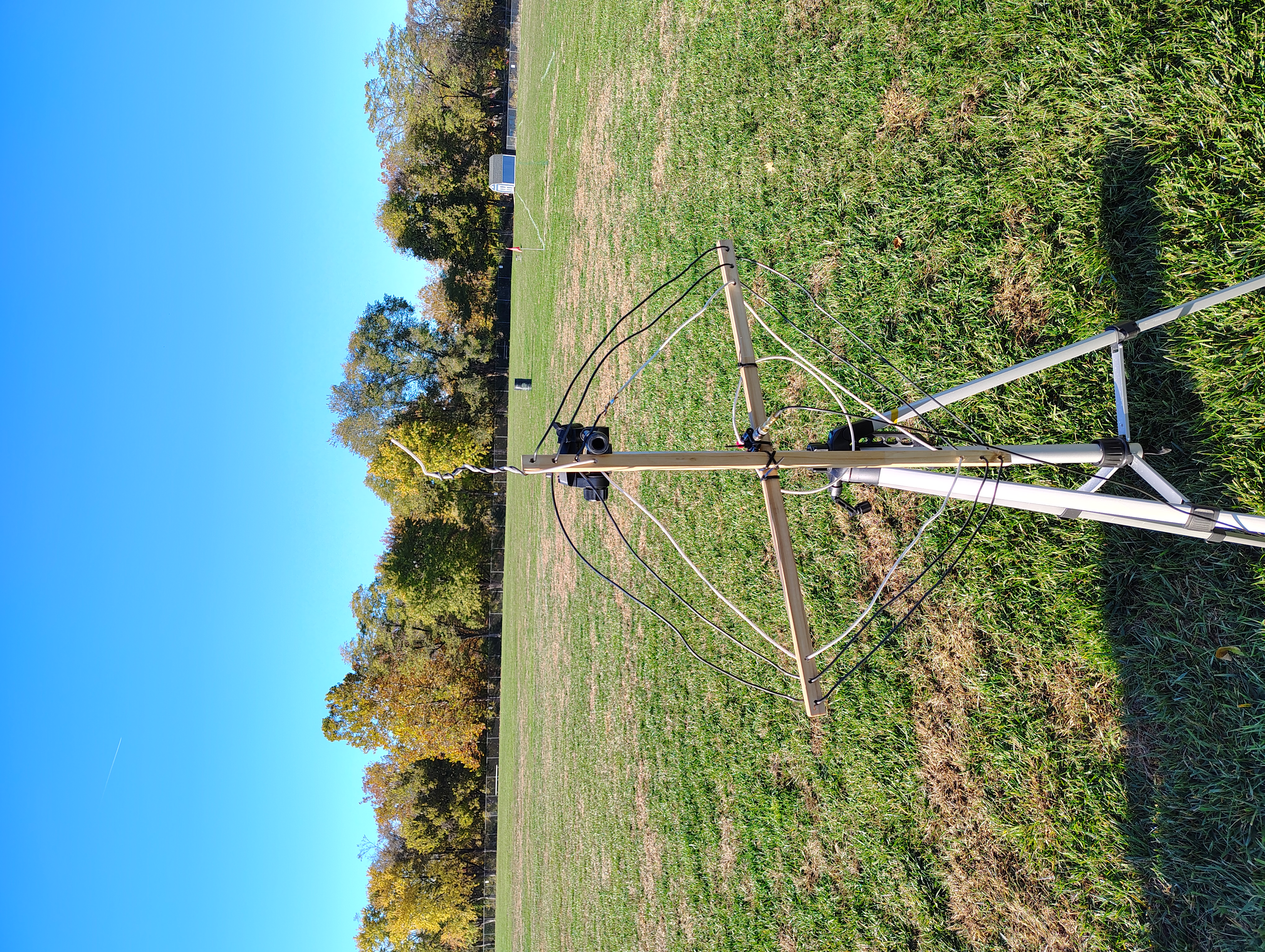
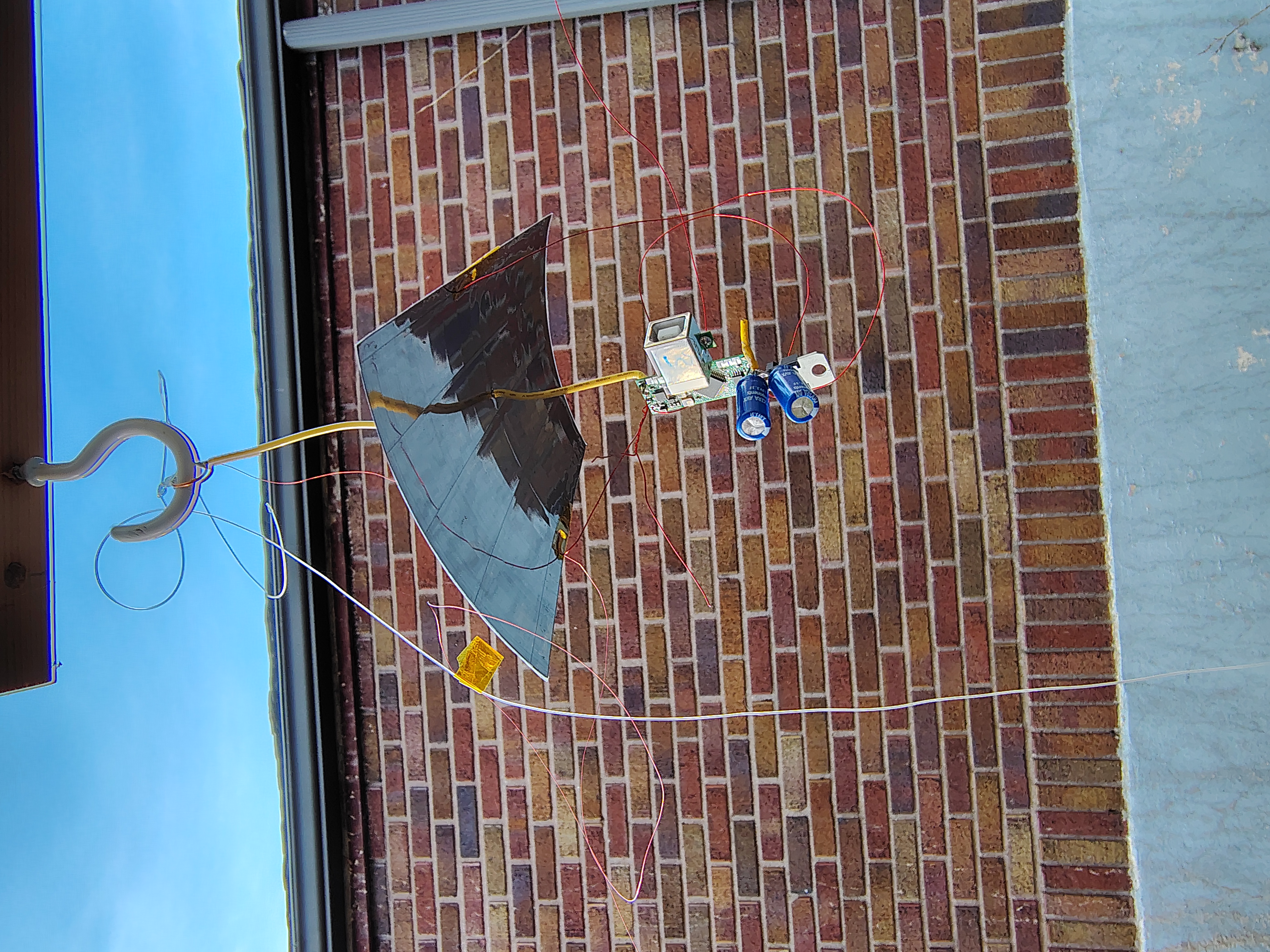
2025-10-16
Set up balloon payload on wooden poles with horizontal wiring in morning of 2025-10-16 and let it start with sunrise.
wspr.rocks spots
Downloaded spot from https://wspr.rocks in both json and tsv format for comparison.
These are the spots from one day of testing 2025-10-16 local time 2025-10-16-wpsr-rocks-spots.json 2025-10-16-wpsr-rocks-spots.tsv
lu7aa spots
https://lu7aa.org.ar/wsprx.asp?banda=All&other=KF8EEZ&balloonid=×lot=&SSID=&launch=&tracker=qrplabs
csv file created by copy/paste from website
2025-10-16-lu7aa-spots.csv
this shows decoded telemetry also https://lu7aa.org/wsprx.asp?banda=20m&other=kf8eez&balloonid=05×lot=8&repito=on&qrpid=109&SSID=11&launch=20251016010101&tracker=qrplabs
wsprtv.com
shows charts https://wsprtv.com/?cs=kf8eez&ch=109&band=20m&start_date=2025-09-17
downloaded csv to KF8EEZ_109_20250917-20251017.cs
power down
Solar panel ends in shadow early due to trees.
Let up over night to allow to start again with sunrise.
2025-10-17
Came back up after overnight testing and starting transmitting. Brought inside due to forecast rain overnight.
2025-10-20
Additonal testing. Working in sun.
2025-10-23
Broke off the USB connector from the U4B and mounted again outside for testing. Partly cloudy but transmitted fine during sun.
Hardware
Part | no | weight |
Powerfilm MPT48-150 | 1 | 3.8 |
supercap AVX_SCC_3_0V-2952762 | 2 | 2.4 |
volt regulator L7805CV | 1 | 1.7 |
u4b | 1 | 5.4 |
upper HF antenna + rigging | 1 | 4.1 |
lower HF antenna | 1 | 0.9 |
TOTAL | | 18.2 |
Configuration
- Callsign: KF8EEZ
- Band: 20m
- Channel: 109
- Autostart: TRACKER2
Programs
Tracker 2
This is the primary program. The MYTELE and MYGPS subroutines enable control of a test mode which doesn’t need GPS or ability to transmit.
PRINT "START TRACKER2"
RUN "INIT"
RUN "SHOW"
PRINT "INITIAL GPS"
RUN "MYGPS"
10 PRINT "LOOP AT #VC"
RUN "SHOW"
RUN "MYTELE"
LET C = C + 1
IF C > N
    LET HP = 1
ENDIF
RUN "MYGPS"
GOTO 10
Init
- C is the count of transmissions since wake up
- N is the number of transmissions before switching to high-power (0-based)
- T is a flag for test mode
- T=1 - test mode
- T=0 - live mode
PRINT "INIT START"
LET CH = 109
LET HP = 0
LET C = 0
LET N = 2
LET T = 0
PRINT "HOST USB:    #US"
PRINT "HIGH POWER:  #HP"
PRINT "FREQUENCY:   #FQ"
PRINT "CHANNEL:     #CH"
PRINT "CALLSIGN:    #CS"
PRINT "TEMPERATURE: #TK"
IF T = 1
PRINT "FAKE GPS/TELE MODE"
ELSE
PRINT "REAL GPS/TELE MODE"
ENDIF
PRINT "INIT DONE"
Show
Prints out the current state
PRINT "SHOW START"
PRINT "LLH:  #LT #LN #AT"
PRINT "GPS:  VALID: #GV LOCK: #GL SPEED: #GS CALIB: #CL"
PRINT "GPS:  NSAT:  #SC"
PRINT "CNT:  #VC"
PRINT "TEMP: #TK"
PRINT "POWR: #HP"
PRINT "SHOW DONE"
MYGPS
This is my GPS program, it lets you use the GPS in a test mode without an actual signal. Don’t acquire GPS if in test mode (T=1)
PRINT "GPS START"
RUN "LEDOFF"
IF T = 0
PRINT "REAL GPS"
GPS 360
ELSE
PRINT "FAKE GPS"
DELAY 2000
ENDIF
RUN "LEDON"
PRINT "GPS END"
MYTELE
Don’t transmit if in test mode (T=1)
PRINT "TELEMETRY START"
RUN "LEDOFF"
IF T = 0
PRINT "REAL TELE"
TELE
ELSE
PRINT "FAKE TELE"
DELAY 2000
ENDIF
RUN "LEDON"
PRINT "TELEMETRY END"
Ground testing telemetry
One set of telemetry from ground testing
251016 1736  35  0.32  14.0970715  KF8EEZ EM79 10          0  0.80  1  1    0  0   0     1   810
251016 1736 -28  0.37  14.0971916  KF8EEZ EM79 10          0  0.47  1  1   56  1  34     1   810
251016 1738  10  0.24  14.0970673  0X5DBN OI57 53          0  0.12  3  1   -8  1  31     1   810
251016 1738  34  0.32  14.0970714  0X5DBN OI57 53          0  0.76  1  1    0  0   0     1   808
251016 1738 -20  0.49  14.0971915  0X5DBN OI57 53          0  0.19  3  1    0  0  13     1   429